

On March 28, 2025, a devastating 7.7 magnitude Myanmar earthquake struck near Mandalay, shaking the region to its core. Just minutes later, a powerful 6.7 aftershock followed, leaving behind widespread destruction, collapsed buildings, and heartbreaking loss of life.
What made this earthquake extraordinary was not only its destructive power on the ground, but the fact that satellites in space recorded the land shifting.
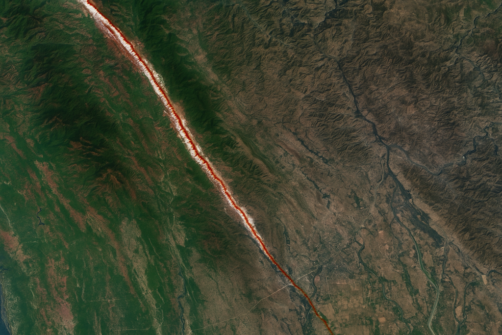
The Ground Moved More Than 10 Feet
The earthquake hit along the Sagaing Fault, a known danger zone in Myanmar. It was shallow too, originating just 10 kilometers beneath the surface, which made the shaking even more severe.
NASA’s Jet Propulsion Laboratory and the European Space Agency used satellites to study the quake’s impact. Their images showed that in some places the earth had moved more than 10 feet (over 3 meters). In total, the fault shifted more than 6 meters — a clear sign of just how powerful the Myanmar earthquake really was.
Lives Lost and Cities Damaged
The human cost of the Myanmar earthquake was heartbreaking. Over 5,400 people lost their lives, and thousands more were injured. Buildings, homes, mosques, and even historic sites crumbled under the force of the quake.
Shockwaves were felt as far away as Bangkok, Thailand — almost 1,000 kilometers from the epicenter — showing just how widespread the disaster was.
Why This Earthquake Was Unusual
Scientists later found that the Myanmar earthquake wasn’t just big — it was also rare. The fault rupture moved so fast that it outran the seismic waves. This type of quake is called a supershear earthquake, and it releases more destructive energy than a normal quake. The rupture stretched across 550 kilometers, which is one of the longest ever recorded for this type of fault.
How Satellites Help During Earthquakes
Thanks to modern satellite technology, scientists were able to quickly map out the areas hardest hit by the Myanmar earthquake. This helped emergency teams focus their rescue efforts where they were needed most.
In disasters like this, satellite data gives experts a clear picture of how the Earth moved and where the damage is most severe, often long before people on the ground can fully assess it.
A Historic Reminder
The Myanmar earthquake of March 2025 will go down in history as one of the country’s strongest and deadliest natural disasters. It’s a sharp reminder of the power of nature and the vital role that technology, like satellite imaging, plays in saving lives and helping recovery efforts when every second counts.
For more of this type of news, visit our website: https://thethoughtbrew.com/

